Brno-Líšeň District Office
Use of existing data
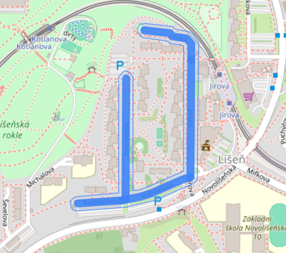
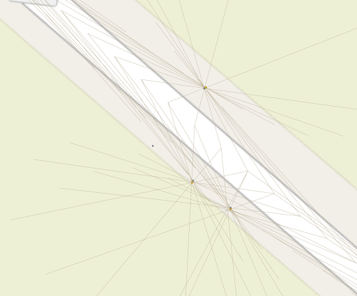
Unique environment for selecting an area for analysis
- Area for analysis selected by clicking on the map
- Selected area highlighted in blue
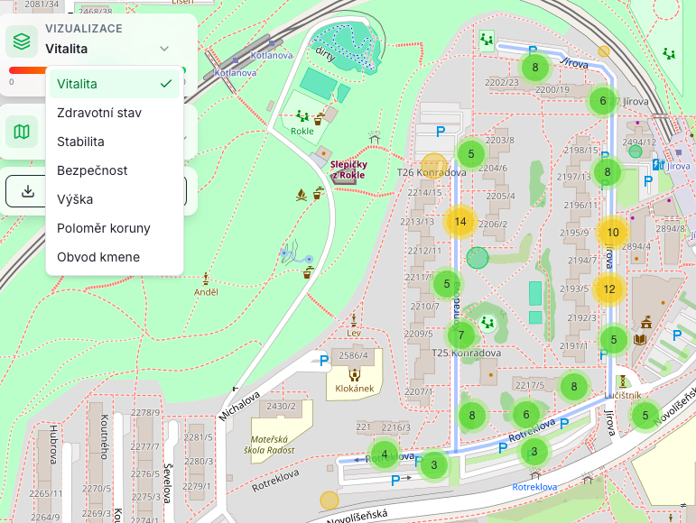
Analysis complete – visual
- Selection of visualization type and map layer
- Simple download of analysis results
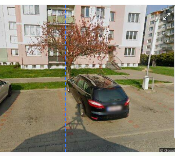
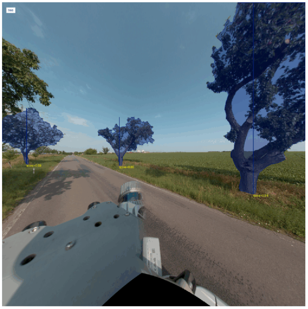
Detail of a selected tree from the analysis
- Display of the tree ‘card’ from the map and additional information
- Option to view from different angles
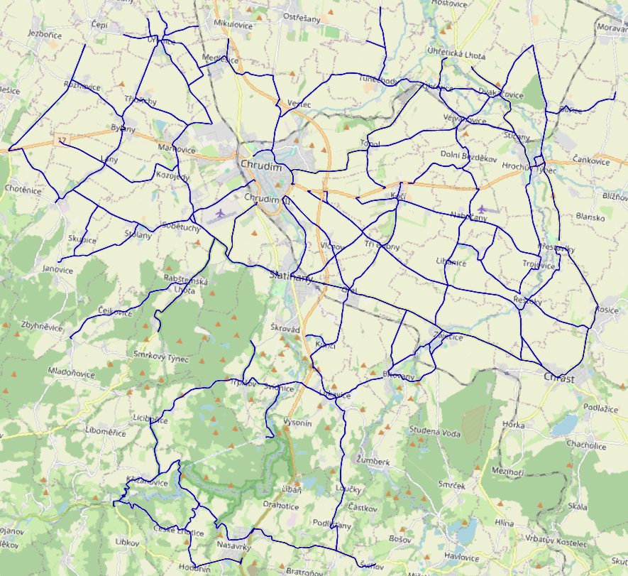
Chrudim & Trees:
counted, summarized
For the Chrudim project, we collaborated with GEODROM and INTEGRA. Thanks to their technologies, it is possible to thoroughly document road surroundings and capture high-quality data using vehicle-mounted cameras or LiDAR. As experienced market leaders, they also have a deep understanding of the requirements and complexities involved in mapping various municipal and regional elements, providing valuable insights into inventory challenges.
Long story short:
3 days. 200 km. And 10,000 surveyed trees.
roadside.vision in practice
Spoiler alert:
Transparent pricing per kilometer of road, not per number of trees.
Unique advantage for public tenders.
9 hours of driving → 225,000 photos
2 days of work → overview of 10,000 trees
200 km of roads in Chrudim mapped
With almost 100% certainty,
we locate and identify individual trees along roadsides,
achieving a 90% success rate in urban areas.
Output examples for Chrudim
Detection of existence
- Freestanding trees
- Built-up area (municipality) – 91% sensitivity, 16% error rate
- Outside built-up area (outside municipality) – 99% sensitivity, 1% error rate
- Groups of trees and continuous stands

Location
(average error +-20cm)
- Tree positioning – knowing its exact location
- Distance from the edge of the road
Genus and tree parameters
(average error +- 15%)
- TOP 3 genus predictions
- Tree height
- Trunk diameter
- Trunk circumference
- Crown diameter, wood volume upon request
Indication of health and safety
(80% accuracy)
- Vitality – 65% sensitivity
- Health – 60% sensitivity
- Stability – 20% sensitivity
- Safety – 20% sensitivity